High resolution tiff file (1.0M)
Location & Time Information
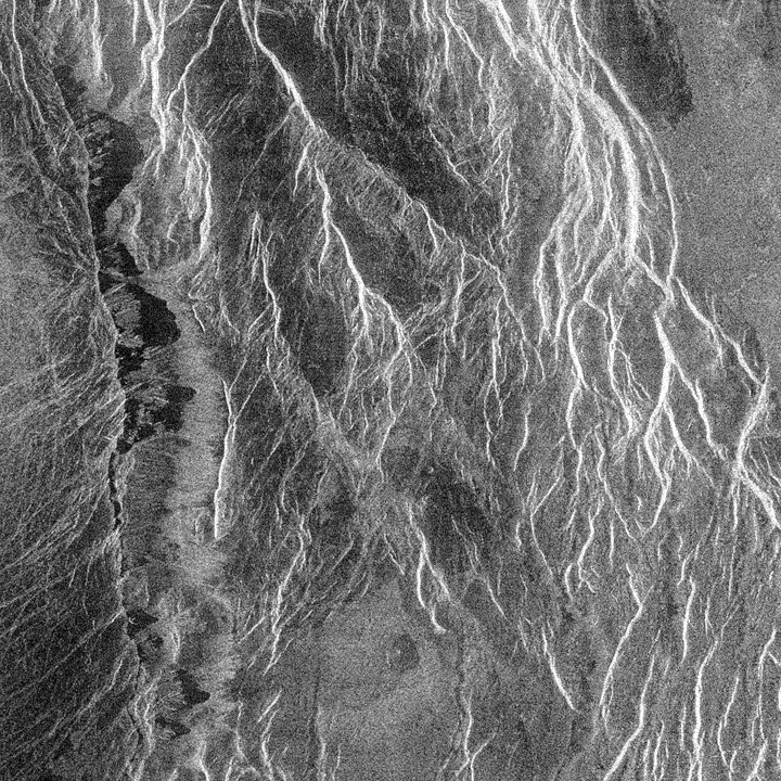
Date/Time (UT): N/A
Distance/Range (km): 420.6
Central Latitude/Longitude (deg): +20.00/280.42
Orbit(s): 1901-1933
Imaging Information
Area or Feature Type: Landslide,Debris flow,Canyon
Instrument: Synthetic Aperture Radar
Instrument Resolution (pixels): 240 x 240, 8 bit
Instrument Field of View (deg): 2.1 x 2.5
Filter: N/A
Illumination Incidence Angle (deg): 44.5-45.2
Phase Angle (deg): 0
Instrument Look Direction: Left
Surface Emission Angle (deg): 44.5-45.2
Ordering Information
CD-ROM Volume: MG_0046
NASA Image ID number: F-20N280;1
Other Image ID number: N/A
NSSDC Data Set ID (Photo): 89-033B-01N
NSSDC Data Set ID (CD): 89-033B-01F
Other ID: N/A
Authors/Curators:
Dave Williams, dave.williams@nasa.gov, (301) 286-1258
Code 690.1, NASA Goddard Space Flight Center
Greenbelt, MD 20771, USA
Jay Friedlander, jay.s.friedlander@nasa.gov, (301) 286-7172
Code 612.4, NASA Goddard Space Flight Center
Greenbelt, MD 20771, USA