High resolution tiff file (7.9M)
Location & Time Information
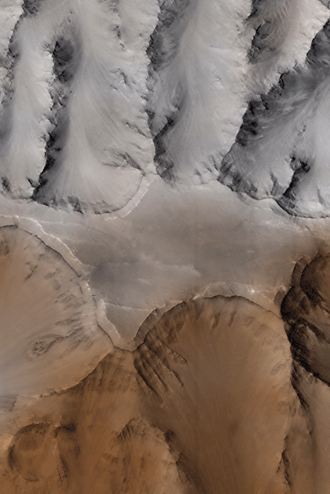
Date/Time (UT): 1998-01-02 T 02:21:46
Distance/Range (km): 1270.39
Central Latitude/Longitude (deg): -14.7, 55.8 W
Orbit(s): 80
Imaging Information
Area or Feature Type: canyon, valles, catena
Instrument: Mars Orbiter Camera (MOC)
Instrument Resolution (pixels): 2048 line array, 8-bit
Instrument Field of View (deg): 0.4
Filter: red, blue
Illumination Incidence Angle (deg): 28.31
Phase Angle (deg): 25.20
Instrument Look Direction: N/A
Surface Emission Angle (deg): 18.68
Ordering Information
CD-ROM Volume: MGSC_0002 (raw images)
NASA Image ID number: MRPS88217
Other Image ID number:
NSSDC Data Set ID (Photo): XD-12A
NSSDC Data Set ID (CD): 96-062A-01A (raw images)
Other ID: AB108003 (raw image)
Authors/Curators:
Dave Williams, dave.williams@nasa.gov, (301) 286-1258
Code 690.1, NASA Goddard Space Flight Center
Greenbelt, MD 20771, USA
Jay Friedlander, jay.s.friedlander@nasa.gov, (301) 286-7172
Code 612.4, NASA Goddard Space Flight Center
Greenbelt, MD 20771, USA