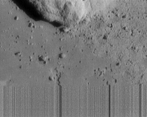
Location & Time Information
Date/Time (UT): 2001-02-12 T 19:42:59
Distance/Range (km): 0.13
Central Latitude/Longitude (deg): -35.7, 279.5
Orbit(s): lander
Imaging Information
Area or Feature Type: crater
Instrument: Multispectral Imager
Instrument Resolution (pixels): 244 x 537
Instrument Field of View (deg): 2.25 x 2.9
Filter: 3
Illumination Incidence Angle (deg): 63.37
Phase Angle (deg): 66.15
Instrument Look Direction: N/A
Surface Emission Angle (deg): 17.97
Ordering Information
CD-ROM Volume: N/A
NASA Image ID number: NEAR_0157417198
Other Image ID number: N/A
NSSDC Data Set ID (Photo): XD-12A
NSSDC Data Set ID (CD): 96-008A-01B
Other ID: N/A
![]() Authors/Curators:
Authors/Curators:
Dave Williams, dave.williams@nasa.gov, (301) 286-1258
Code 690.1, NASA Goddard Space Flight Center
Greenbelt, MD 20771, USA
Jay Friedlander, jay.s.friedlander@nasa.gov, (301) 286-7172
Code 612.4, NASA Goddard Space Flight Center
Greenbelt, MD 20771, USA