High resolution tiff file (1.0M)
Location & Time Information
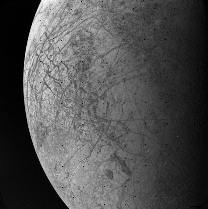
Date/Time (UT): 1979-07-09 T 15:11:57
Distance/Range (km): 226,560.3
Central Latitude/Longitude (deg): -19.33, 170.06
Orbit(s): Flyby
Imaging Information
Area or Feature Type: global view
Instrument: Narrow Angle Vidicon Camera
Instrument Resolution (pixels): 800 x 800, 8 bit
Instrument Field of View (deg): .424 x .424
Filter: clear (0)
Illumination Incidence Angle (deg): 56.42
Phase Angle (deg): 93.74
Instrument Look Direction: N/A
Surface Emission Angle (deg): 37.38
Ordering Information
CD-ROM Volume: VG_0002
NASA Image ID number: FDS 20650.22
Other Image ID number: 1255J2-001
NSSDC Data Set ID (Photo): 77-076A-01D
NSSDC Data Set ID (CD): 77-076A-01V
Other ID: N/A
Authors/Curators:
Dave Williams, dave.williams@nasa.gov, (301) 286-1258
Code 690.1, NASA Goddard Space Flight Center
Greenbelt, MD 20771, USA
Jay Friedlander, jay.s.friedlander@nasa.gov, (301) 286-7172
Code 612.4, NASA Goddard Space Flight Center
Greenbelt, MD 20771, USA