High resolution tif file (1.1M)
Location & Time Information
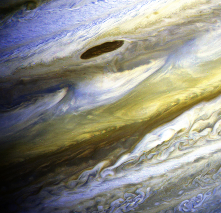
Date/Time (UT): 1979-06-28
Distance/Range (km): 10,300,000
Central Latitude/Longitude (deg): N/A
Orbit(s): Flyby
Imaging Information
Area or Feature Type: clouds
Instrument: Narrow Angle Vidicon Camera
Instrument Resolution (pixels): 800 x 800, 8 bit
Instrument Field of View (deg): .424 x .424
Filter: 3 filters
Illumination Incidence Angle (deg): N/A
Phase Angle (deg): N/A
Instrument Look Direction: N/A
Surface Emission Angle (deg): N/A
Ordering Information
CD-ROM Volume: N/A
NASA Image ID number: P-21731
Other Image ID number: FDS 20321.49, FDS 20321.51, FDS 20321.53
NSSDC Data Set ID (Photo): NSD XD-12A
NSSDC Data Set ID (CD): N/A
Other ID: N/A
Authors/Curators:
Dave Williams, dave.williams@nasa.gov, (301) 286-1258
Code 690.1, NASA Goddard Space Flight Center
Greenbelt, MD 20771, USA
Jay Friedlander, jay.s.friedlander@nasa.gov, (301) 286-7172
Code 612.4, NASA Goddard Space Flight Center
Greenbelt, MD 20771, USA