High resolution tiff file (1.0M)
Location & Time Information
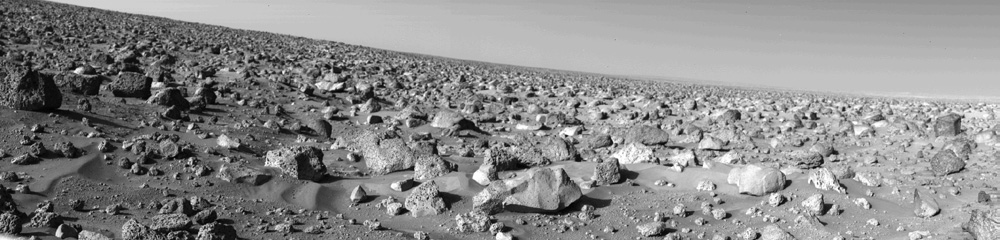
Date/Time (UT): 1976-09-05
Distance/Range (km): .001
Central Latitude/Longitude (deg): +44.57, 225.74
Orbit(s): lander
Imaging Information
Area or Feature Type: lander image, surface, rock
Instrument: Viking lander camera A
Instrument Resolution (pixels): 512 (vertical), 6 bit
Instrument Field of View (deg): 100 x 0.12 (single scan), 100 x 342.5 (max.)
Filter: clear
Illumination Incidence Angle (deg): N/A
Phase Angle (deg): N/A
Instrument Look Direction: N/A
Surface Emission Angle (deg): N/A
Ordering Information
CD-ROM Volume: N/A
NASA Image ID number: P-17688
Other Image ID number: 22A011/001
NSSDC Data Set ID (Photo): 75-083C-06F
NSSDC Data Set ID (CD): N/A
Other ID: N/A
![]() Authors/Curators:
Authors/Curators:
Dave Williams, dave.williams@nasa.gov, (301) 286-1258
Code 690.1, NASA Goddard Space Flight Center
Greenbelt, MD 20771, USA
Jay Friedlander, jay.s.friedlander@nasa.gov, (301) 286-7172
Code 612.4, NASA Goddard Space Flight Center
Greenbelt, MD 20771, USA