- Sunday, 13 July 2025
MGS Mars Orbiter Laser Altimeter (MOLA) Data Archive on CD-ROM (PDS)
NSSDCA ID: PSPG-00296
Availability: At NSSDC, Ready for Offline Distribution (or Staging if Digital)
Description
This data set contains archive data from the Mars Global Surveyor (MGS) Mars Orbiter Laser Altimeter (MOLA) from both the orbit insertion and mapping phases of the mission. The data contains information on the timing and position of laser shots and returns, and other instrument parameters for each shot. The orbit insertion phase data consists of raw data in Aggregated Experiment Data Records (AEDRs), data from the AEDRs with orbit corrections applied; Precision Experiment Data Records (PEDRs), and gridded products derived from PEDRs; Experiment Gridded Data Records (EGDRs). The first two volumes (MGSL_0001 and _0002) contain data from the Orbit Insertion Phase of the mission: the Aerobraking Hiatus and the Science Phasing Orbit 1 and 2 (SPO-1 and SPO-2) Subphases. These volumes do not contain any EGDR's due to the sparseness of this early data. The later volumes (MGSL_2001 and above) contain data from the Mapping Phase of the mission in the form of PEDRs, EGDRs, and SHADRs (Spherical Harmonics Data Records). The first volume of these, MGSL_2001, also contains some data from the orbit insertion phase.
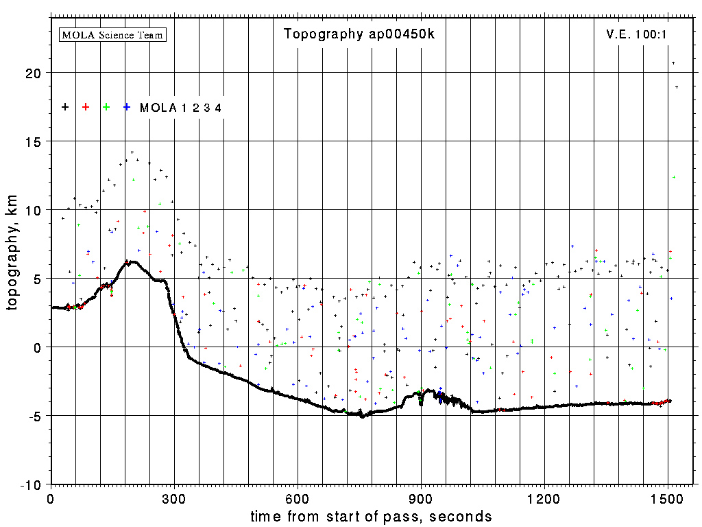
The AEDR's and PEDR's are stored as binary data files (MGS-M-MOLA-1-AEDR-L0-V1.0 and MGS-M-MOLA-3-PEDR-L1A-V1.0). The PEDRs are also stored as ASCII tables (MGS-M-MOLA-3-PEDR-ASCII-V1.0) on the orbital insertion phase CDs. Also on the orbital insertion phase CDs is a set of GIF images of topography profiles derived from the PEDRs, to be used as a means of browsing the PEDR data set. The PEDR contains MOLA science mode telemetry data that has been converted to engineering and physical units. Each PEDR contains a 2 second span of data, called a frame. In addition to the frame data, the engineering and housekeeping data are retained, as well as data correction values which were used to process the telemetry data into the PEDR data. Contained in a PEDR are the range value computed at the frame mid-point, the planetary radius at the frame mid-point, and the planetary radius for each shot. There are 20 possible shots in a 2 second frame, numbered from 1-20. Additionally, ground and spacecraft location, i.e., latitude, longitude, and radial distance, obtained from the precision orbit data for the frame mid-point, is stored in the PEDR. The change in latitude and longitude per frame is also stored.
The EGDR (MGS-M-MOLA-5-EGDR-L3-V1.0) is a topographic map of Mars based on altimetry data acquired by the MOLA instrument and accumulated over the course of the mission so far. Version 1 of the EGDR on CD Volumes up to MGSL_2009 is in the form of an ASCII table with one row for each 1 by 1 degree latitude-longitude bin, from 90 to -90 degrees latitude and from 0 to 360 degrees longitude. Other EGDR's (IEGDR's and MEGDR's) are on these and later volumes. The binned data include all MOLA nadir observations from the Orbit Insertion phase, plus Mapping Phase nadir observations from the beginning of mapping through the end of May 1999, plus off-nadir observations of the north pole above 86 degrees latitude acquired during spring 1998. A row of data contains (for each bin, 1 x 1 or 1/2 x 1/2 degree square, for volume 2023 1/4 x 1/4 degree): mid-bin longitude, mid-bin latitude, mean measured planetary radius in the bin, mean areoid radius in the bin, measured topography, and number of observations. The EGDR's from volume MGSL_2024 on (version 2) are in the form of images (.img files) which can be read by NASAView software. These images have resolutions up to 1/16 degree starting at volume MGSL_2032. The Initial Experiment Gridded Data Record (IEGDR - MGS-M-MOLA-5-IEGDR-L3-V1.0), consists of data accumulated through the first 30 days of the mapping mission, mapped to a global 1 by 1 degree grid. The Spherical Harmonics Topography Model (SHADR - MGS-M-MOLA-5-SHADR-V1.0) is a numerical transform of the Experiment Gridded Data Record (EGDR). The Mission Experiment Gridded Data Record (MEGDR), consisting of data accumulated over the whole primary mission (one Mars year), mapped to a 0.25 by 0.25 degree grid, is still pending completion. More than one version of the IEGDR and MEGDR products may be released.
Detailed description of the content of the data files is stored on the CD-ROM. The MOLA ranges and precision orbit data are preliminary, and will be revised as our knowledge of the spacecraft and the martian gravity field improves. The CD-ROM has been formatted so that a variety of computer systems (e.g., PC, Macintosh, and Sun) may access the data. Specifically, it is formatted according to the ISO-9660 level 1 Interchange Standard.
These data are available on-line from the Planetary Data System at:
Alternate Names
- PDS MGS/MOLA Data Archive
- MGS-M-MOLA-1-AEDR-L0-V1.0
- MGS-M-MOLA-3-PEDR-ASCII-V1.0
- MGS-M-MOLA-3-PEDR-L1A-V1.0
- MGS-M-MOLA-5-EGDR-L3-V1.0
- MGS-M-MOLA-5-IEGDR-L3-V1.0
- MGS-M-MOLA-5-SHADR-V1.0
Discipline
- Planetary Science: Geology and Geophysics
Old NSSDCA ID
- 96-062A-03A
Additional Information
Spacecraft
Experiments
Questions and comments about this data collection can be directed to: Dr. David R. Williams
Personnel
| Name | Role | Original Affiliation | |
|---|---|---|---|
| Ms. Susan Slavney | Data Provider | slavney@wunder.wustl.edu | |
| Mr. | General Contact | Washington University | geosci@wunder.wustl.edu |