
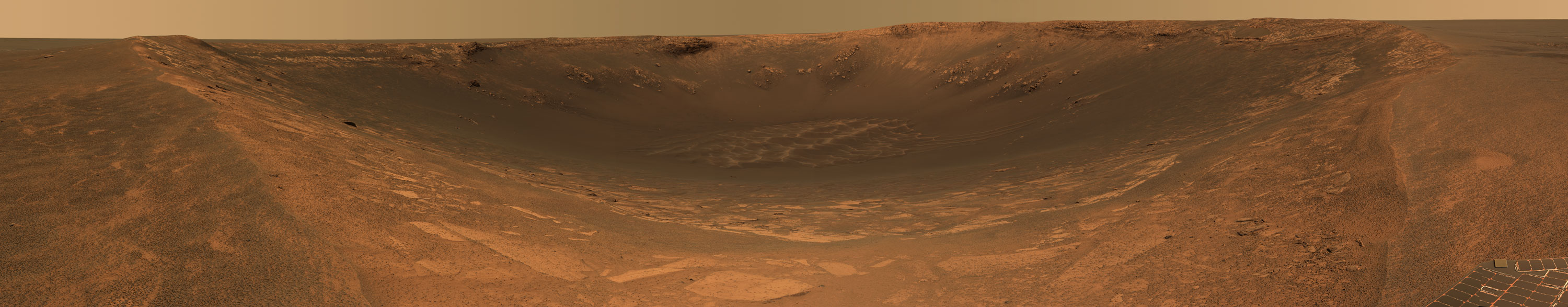
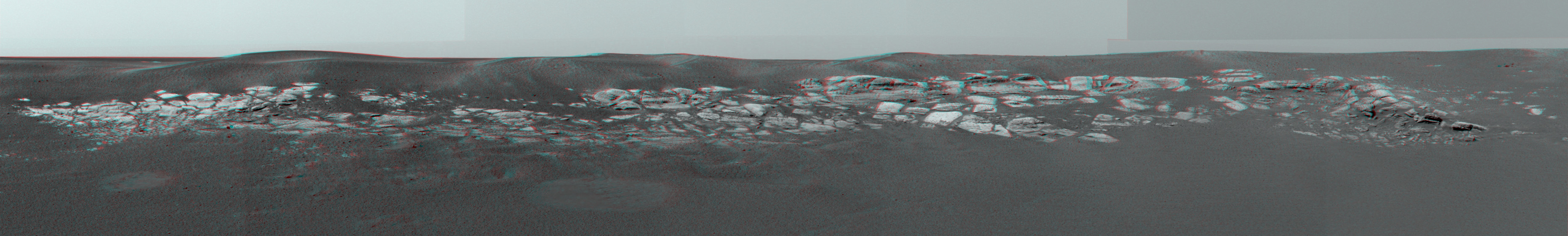
This false-color image from NASA's Mars Exploration Rover Opportunity
panoramic camera shows a downward view from the rover as it sits at the edge
of "Endurance" crater. The gradual, "blueberry"-strewn slope before the
rover contains an exposed dark layer of rock that wraps around the upper
section of the crater. Scientists suspect that this rock layer will provide
clues about Mars' distant past. This mosaic image comprises images taken
from 10 rover positions using 750, 530 and 430 nanometer filters, acquired
on sol 131 (June 6, 2004).

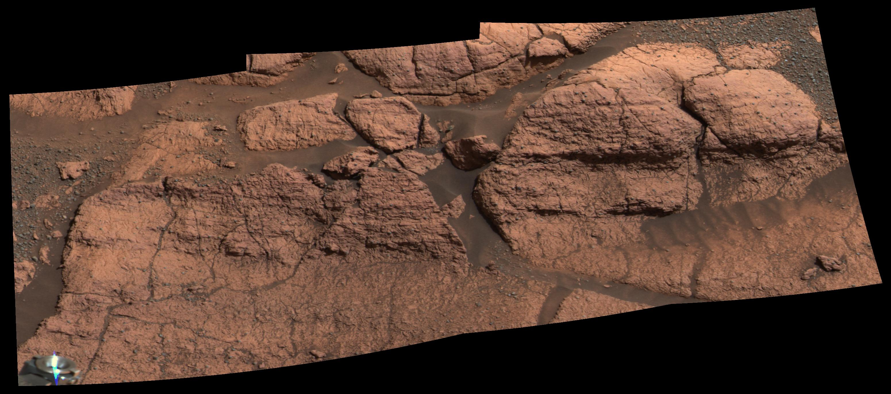
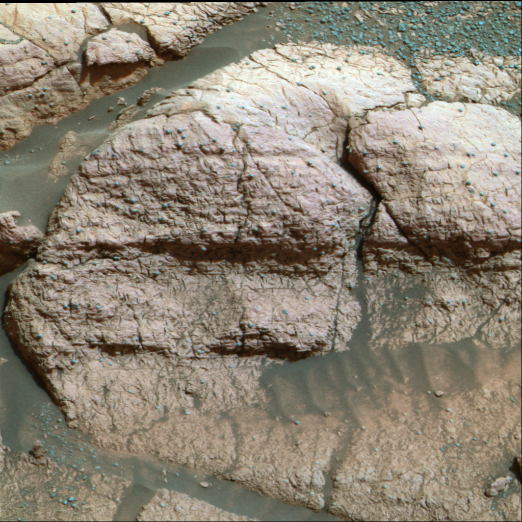
This false-color image shows the area within "Endurance Crater," currently
being investigated by the Mars Exploration Rover Opportunity. The rover is
inspecting a hole it drilled into a flat rock (center) dubbed "Tennessee,"
which scientists believe may be made up of the same evaporite-rich materials
as those found in "Eagle Crater."
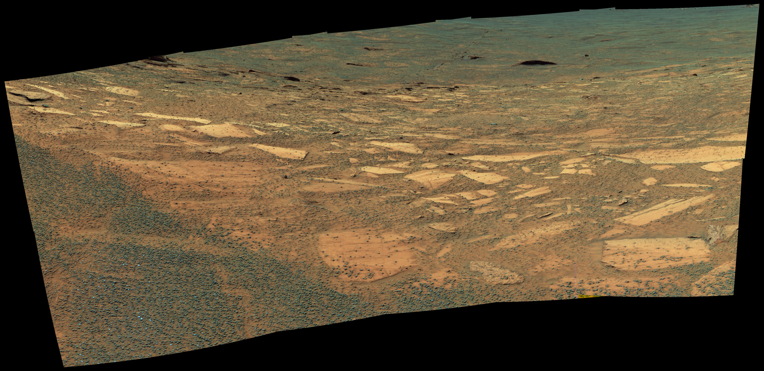
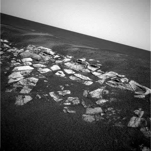
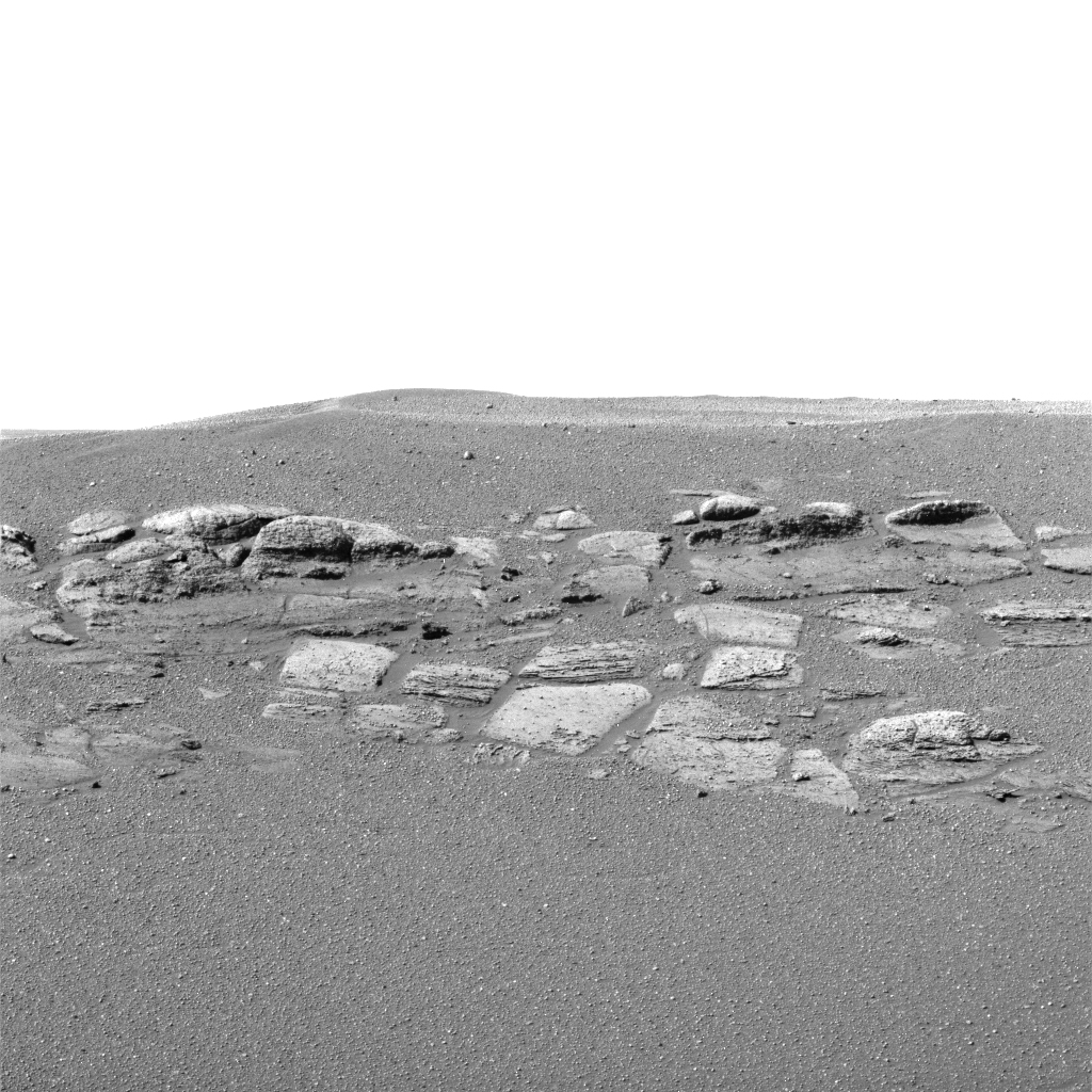
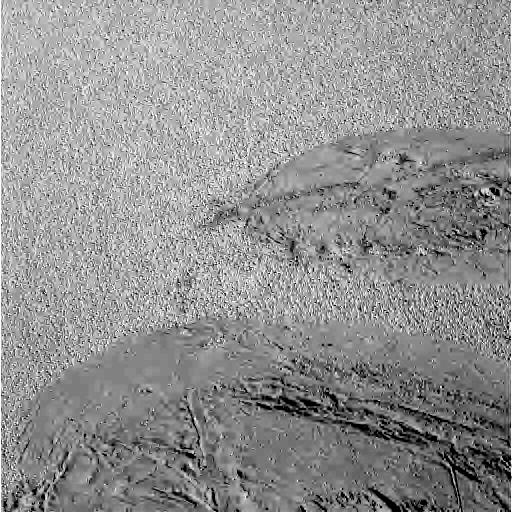
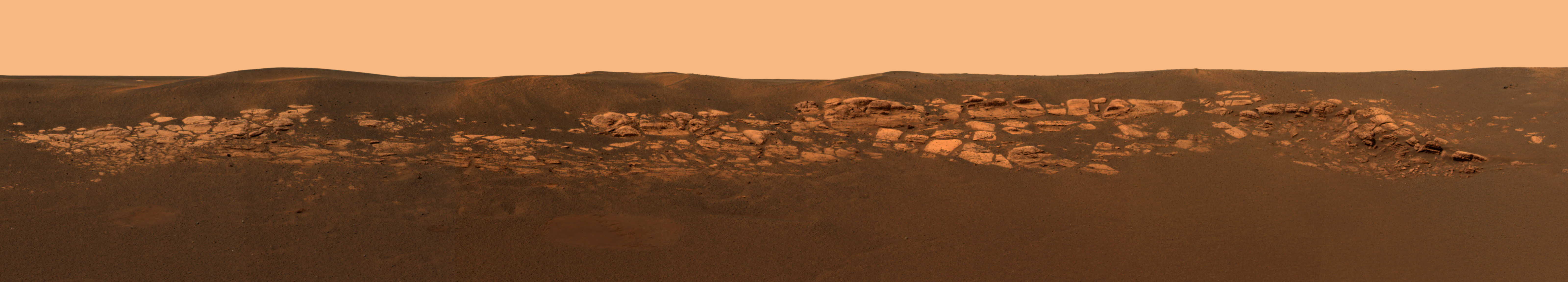
The overall geography inside Endurance is more complex than scientists
anticipated, with at least three distinct bands of rock visible in front of
the rover. Scientists hope to investigate the second and third layers of
rock for more clues to Mars' history. This image was taken on sol 133 (June
8, 2004) with the rover's panoramic camera, using the 750-, 530- and
430-nanometer filters.
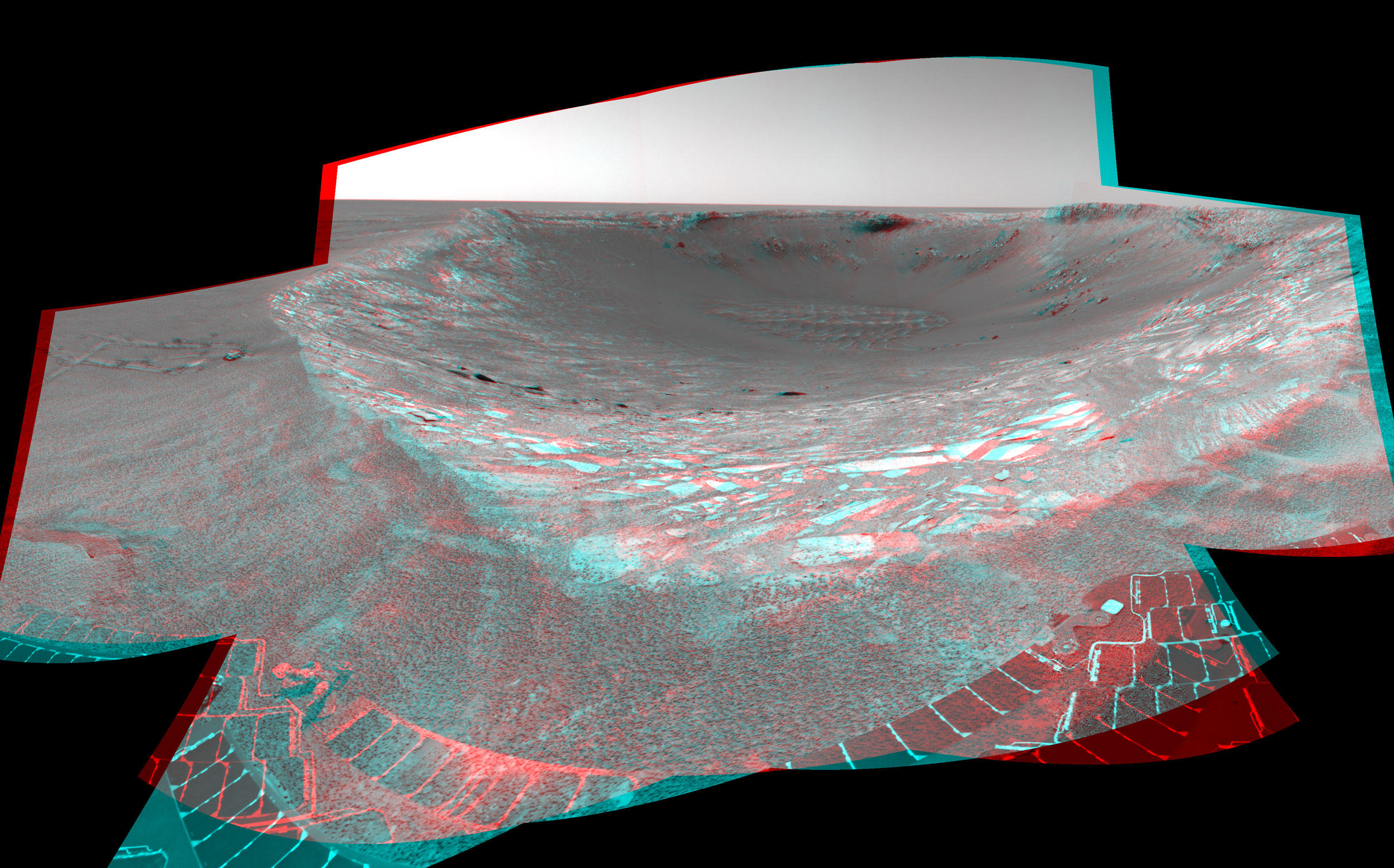
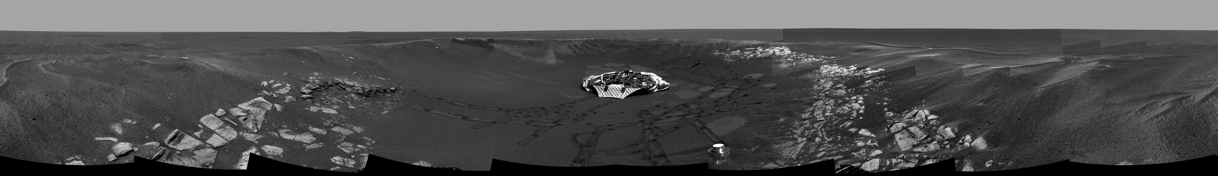
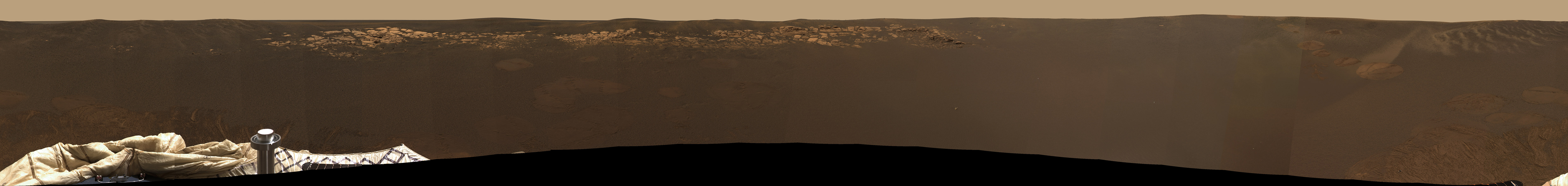
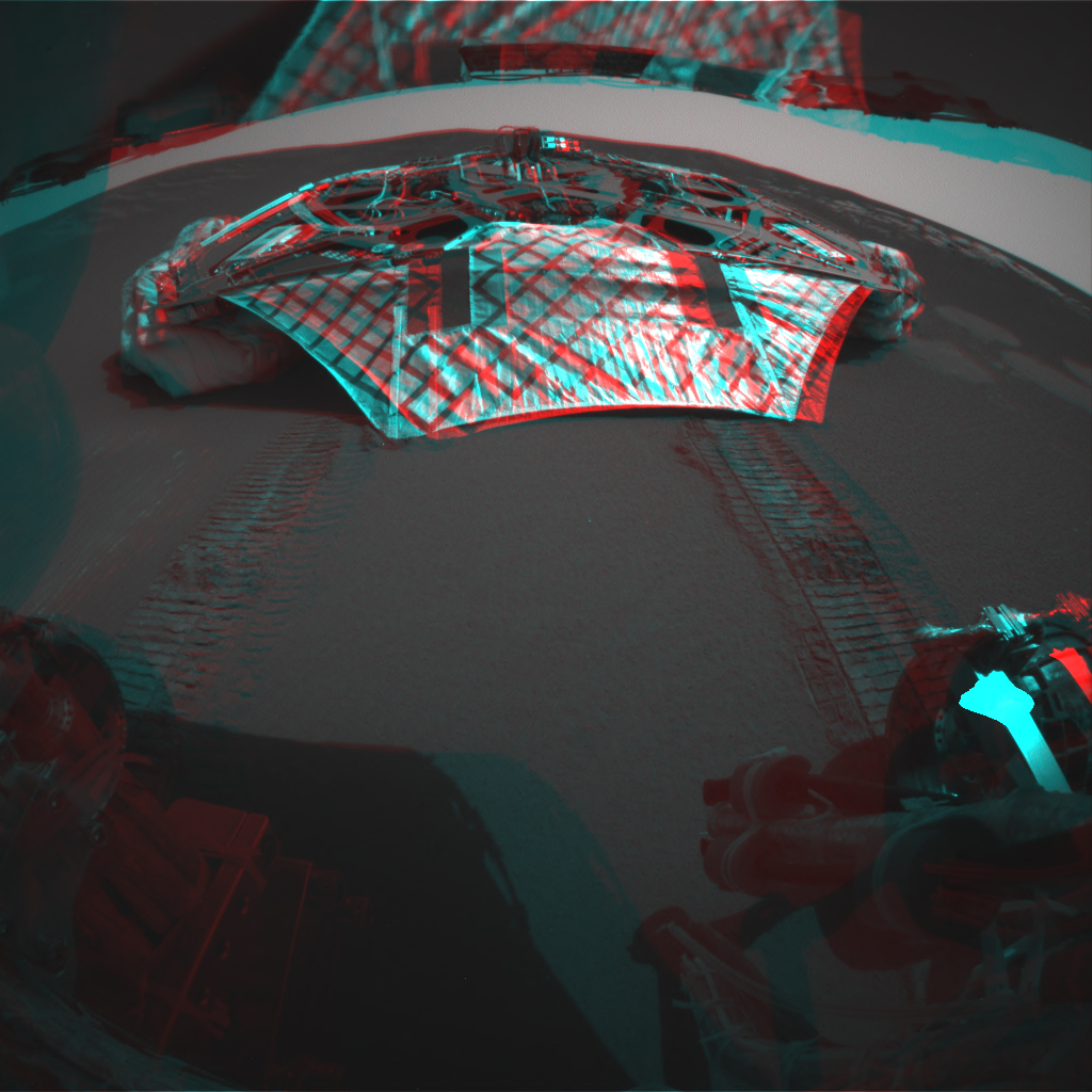
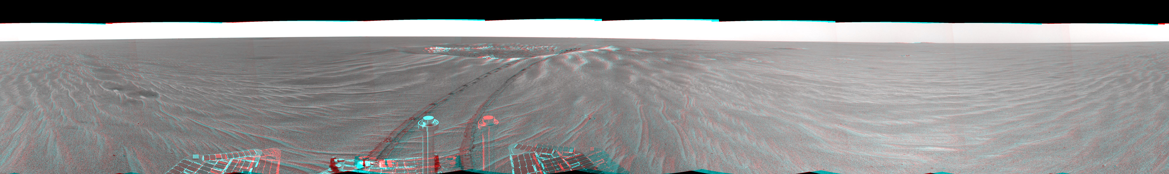
This stereo anaglyph looking toward the northeast across "Endurance Crater"
in Mars' Meridiani Planum region was assembled from frames taken by the
navigation camera on NASA's Mars Exploration Rover Opportunity during the
rover's 131st martian day, or sol, on June 6, 2004. That was two sols before
Opportunity entered the crater, taking the route nearly straight ahead in
this image into the "Karatepe" area of the crater. This view is a
cylindrical-perspective projection with geometric seam correction.
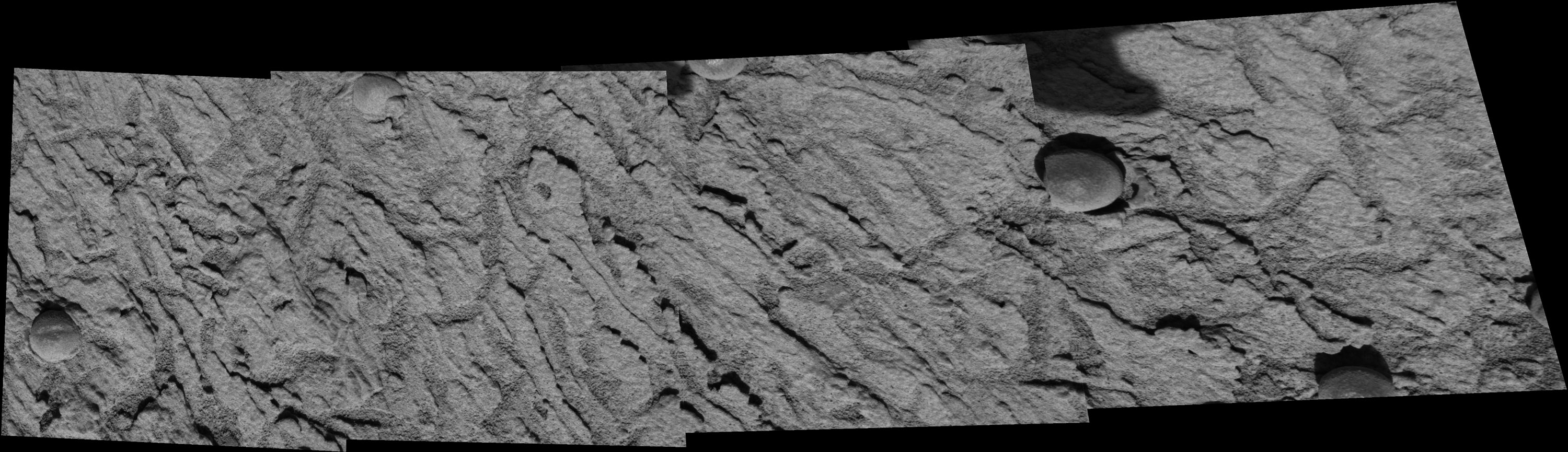
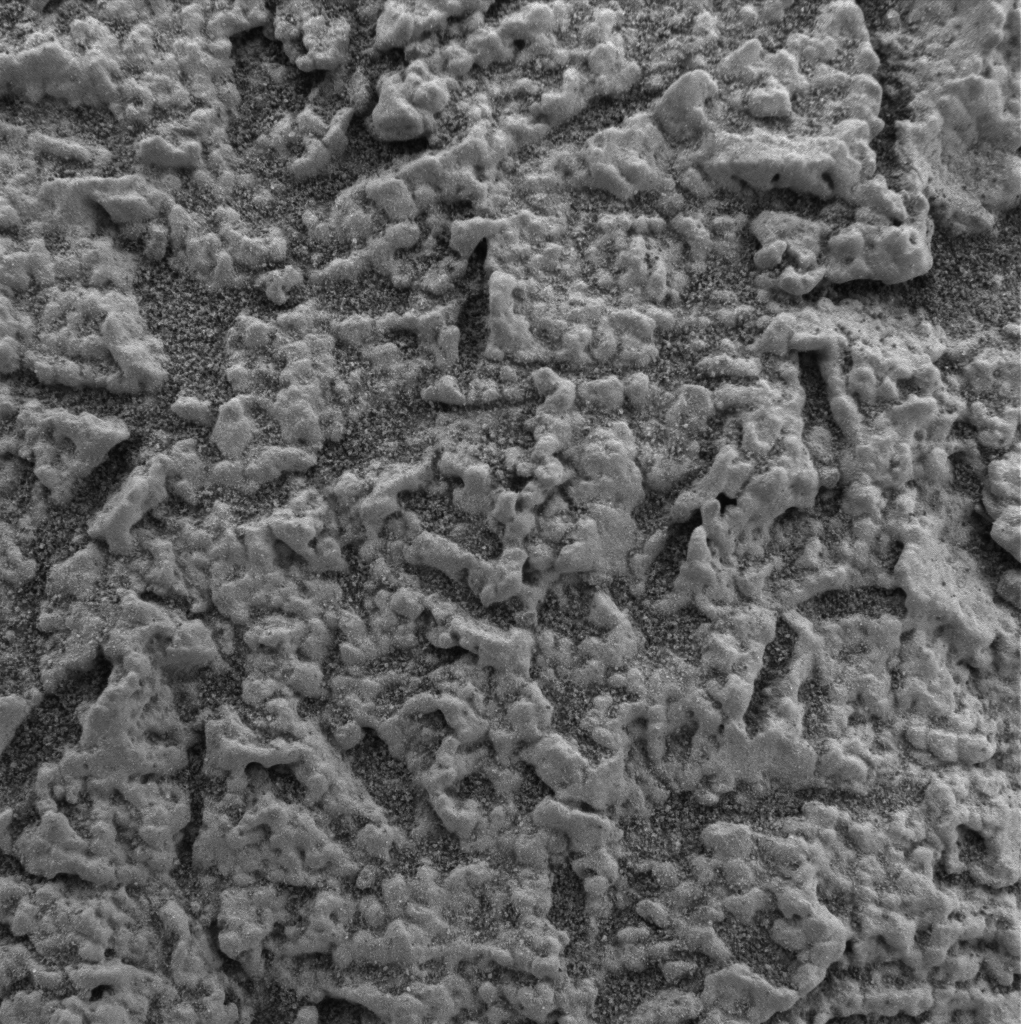
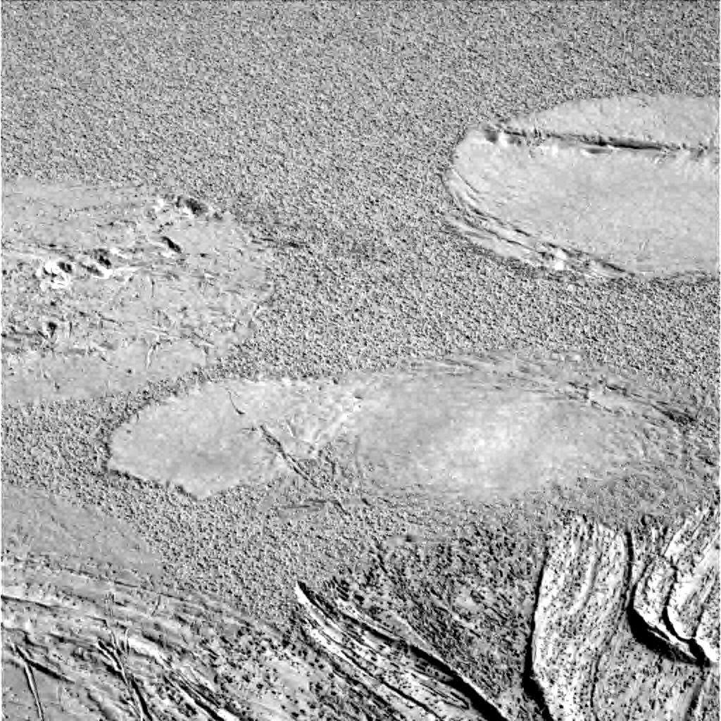
Scientists are investigating the ripples and textures seen in this 4-panel
mosaic image, taken by the microscopic imager on the instrument deployment
device or "robotic arm" of NASA's Mars Exploration Rover Opportunity. The
images were taken from "Panoramic Position 2" on the southeast side of the
rim of "Endurance" Crater. This small set of nearly 150 images was acquired
to examine small-scale ripple patterns suggestive of past aqueous processes
on Mars.
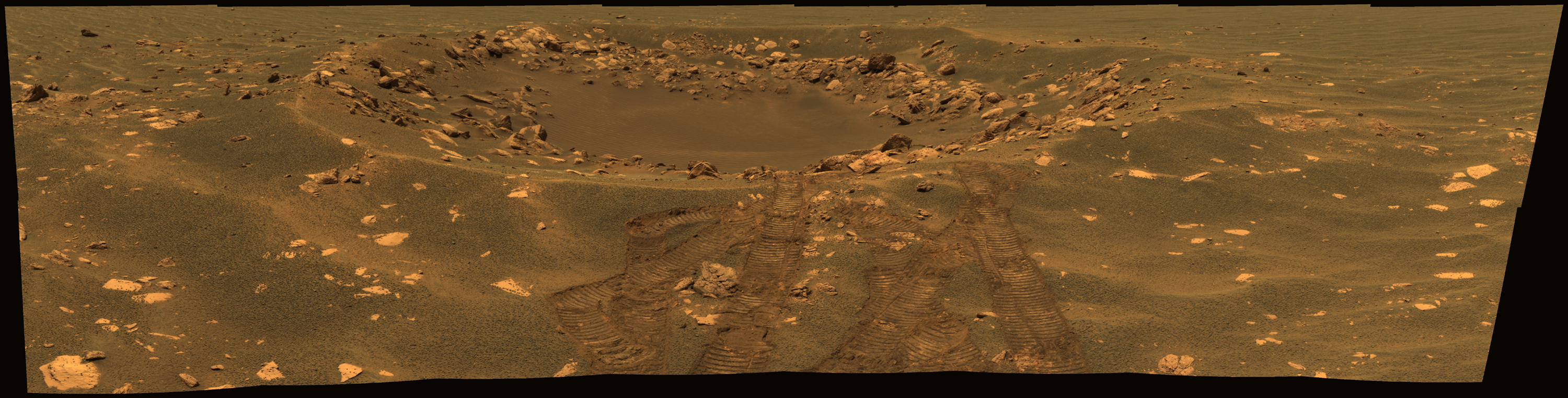
This view in approximately true color reveals details in an impact crater
informally named "Fram" in the Meridian Planum region of Mars. The picture
is a mosaic of frames taken by the panoramic camera on NASA's Mars
Exploration Rover Opportunity during the rover's 88th martian day on Mars,
on April 23, 2004. The crater spans about 8 meters (26 feet) in diameter.
Opportunity paused beside it while traveling from the rover's landing site
toward a larger crater farther east. This view combines images taken using
three of the camera's filters for different wavelengths of light: 750
nanometers, 530 nanometers and 430 nanometers.
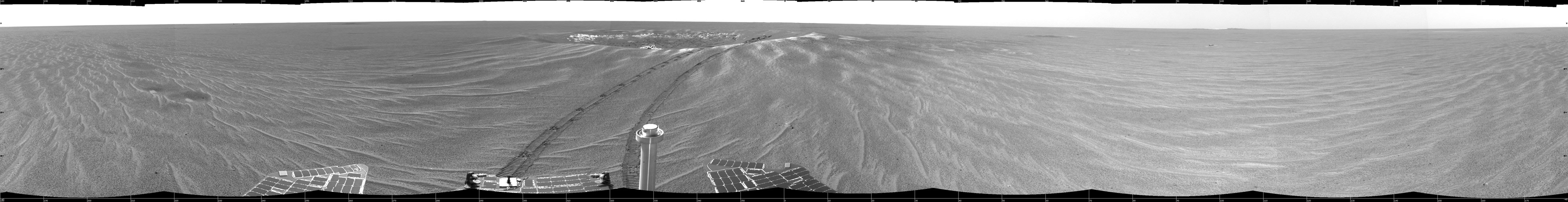
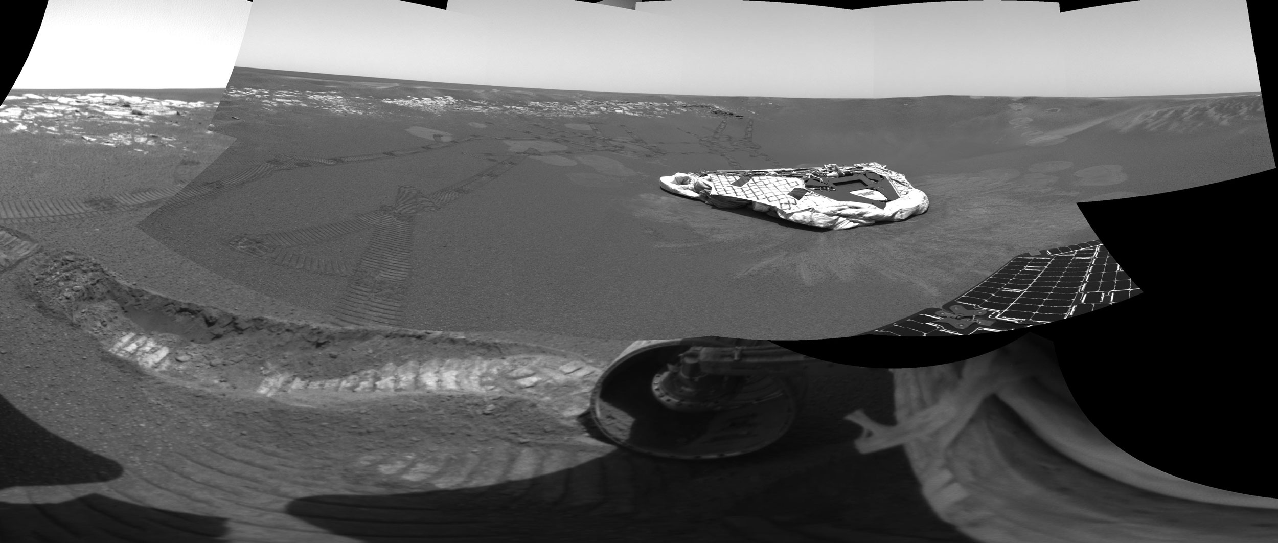
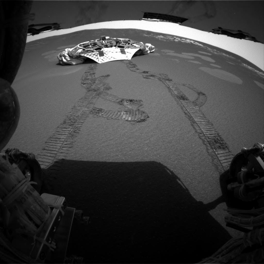
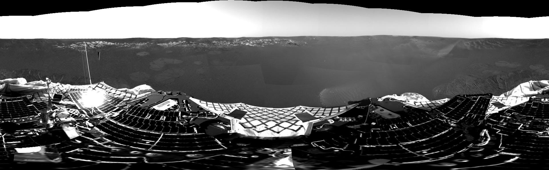
This image mosaic, compiled from navigation and panoramic camera images during the Mars Exploration Rover
Opportunity's 33rd, 35th, and 36th sols on Mars, shows a panoramic view of the crater where the rover had
been exploring since its dramatic arrival in late January 2004. The crater, now informally referred to as
"Eagle Crater," is approximately 22 meters (72 feet) in diameter. Opportunity's lander is visible in the
center of the image. Track marks reveal the rover's progress. The rover cameras recorded this view as
Opportunity climbed close to the crater rim as part of a soil survey campaign.
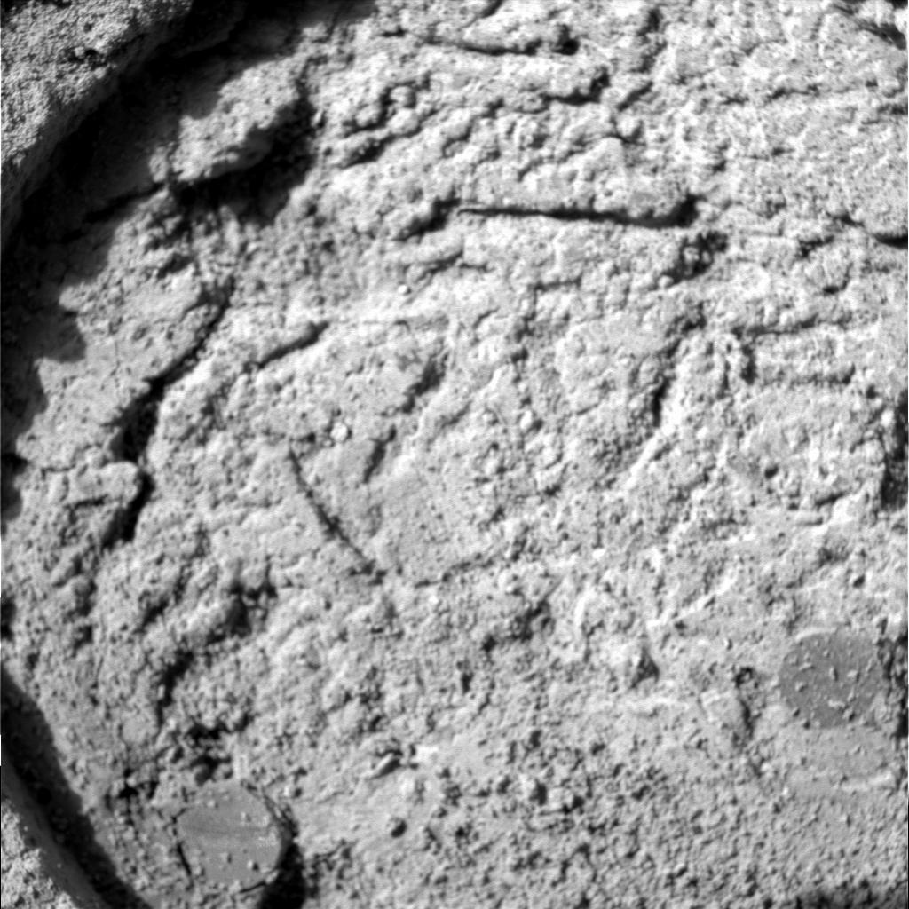
This image, taken by the panoramic camera on the Mars Exploration Rover Opportunity, shows a close up of
the rock dubbed "El Capitan," located in the rock outcrop at Meridiani Planum, Mars. This image shows fine,
parallel lamination in the upper area of the rock, which also contains scattered sphere-shaped objects
ranging from 1 to 2 millimeters (.04 to .08 inches) in size.
This image, taken by the microscopic imager on the Mars Exploration Rover Opportunity, shows a geological
region of the rock outcrop at Meridiani Planum, Mars dubbed "El Capitan." The region was in a shadow when
the image was acquired. Several images, each showing a different part of this region in good focus, were
merged to produce this view. The area in this image, taken on Sol 28 of the Opportunity mission, is
approximately 3 centimeters (1.2 inches) across.
The rock is thoroughly pocked with indentations about a centimeter (0.4 inch) long and one-fourth or less
that wide, with apparently random orientations. This distinctive texture is familiar to geologists as the
sites where crystals of salt minerals form within rocks that sit in briny water. When the crystals later
disappear, either by erosion or by dissolving in less-salty water, the voids left behind are called vugs,
and in this case they conform to the geometry of possible former evaporite minerals.
This image, taken by the microscopic imager on the Mars Exploration Rover Opportunity, shows a geological
region of the rock outcrop at Meridiani Planum, Mars dubbed "El Capitan."
Light from the top is illuminating the region. Several images, each showing a different part of this region
in good focus, were merged to produce this view. The area in this image, taken on Sol 28 of the Opportunity
mission, is 1.5 centimeters (0.6 inches) across.
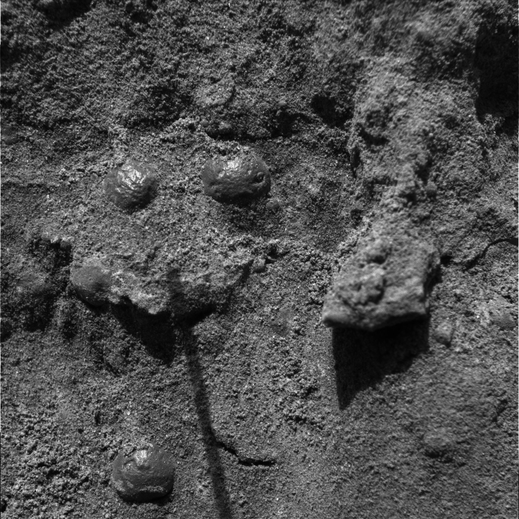
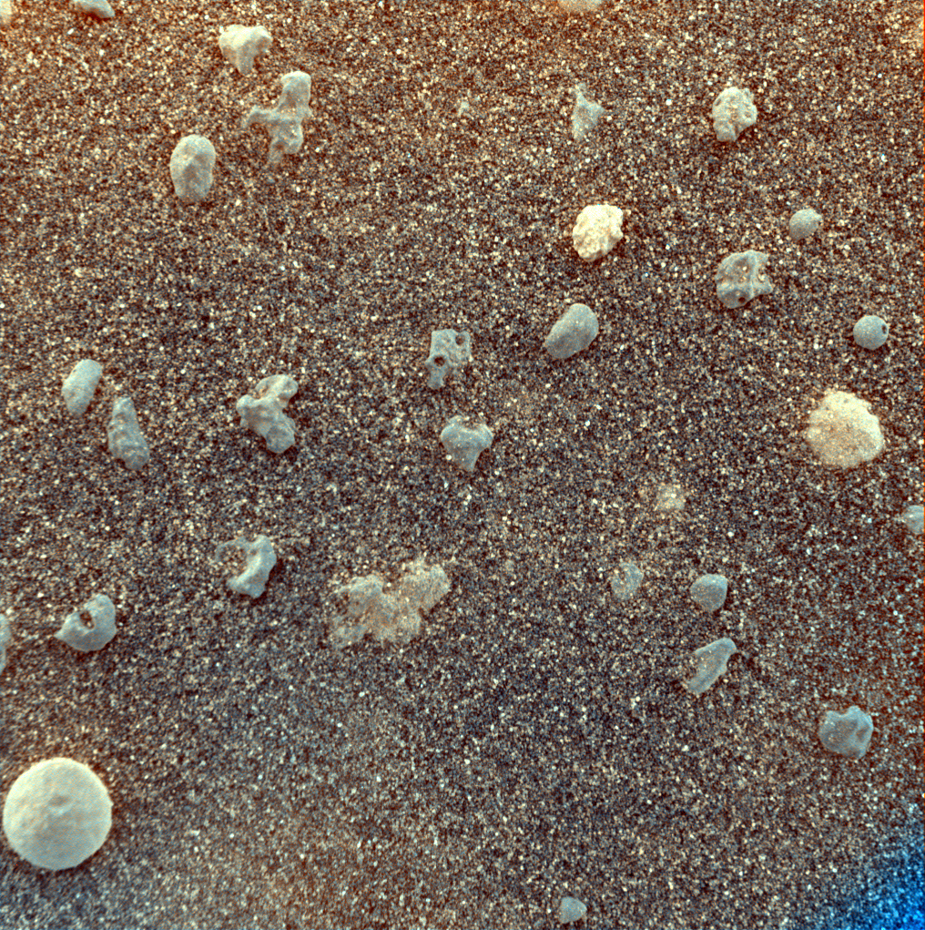
Round particles the size of BBs are embedded in the outcrop. From shape alone, these spherules might be
formed from volcanic eruptions, from lofting of molten droplets by a meteor impact, or from accumulation
of minerals coming out of solution inside a porous, water-soaked rock. Opportunity's observations that the
spherules are not concentrated at particular layers in the outcrop weigh against a volcanic or impact origin,
but do not completely rule out those origins.
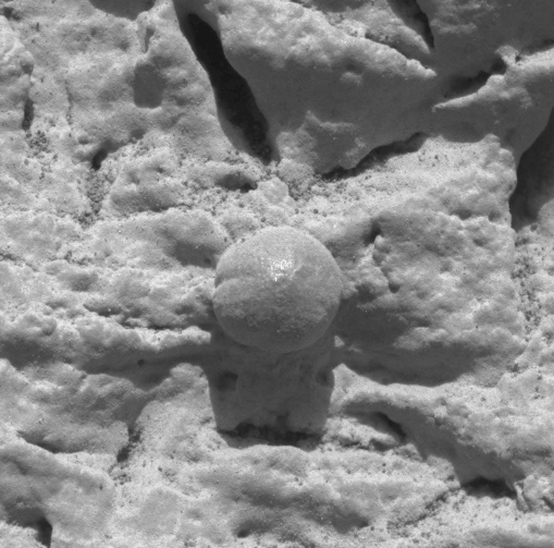
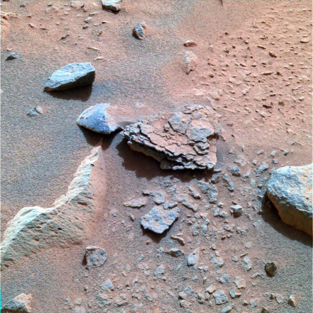
This microscopic image shows the results from Opportunity's first grinding of a rock on Mars. The rock abrasion
tool sliced into the surface about 4 millimeters (0.16 inches) deep and ground off a patch 45.5 millimeters
(1.8 inches) in diameter on a rock called "McKittrick" during Opportunity's 30th sol on Mars, Feb. 23, 2004.
The hole exposed fresh interior material of the rock for close inspection by the rover's microscopic imager and
two spectrometers on the robotic arm.
Scientists and engineers got a nice bonus in that two spherical features nicknamed "blueberries" were unexpectedly cut in half within this rock. Team members had noticed the blueberries in earlier pictures on other rocks in the outcrop and had wanted to attempt to cut one in half sometime during the future of the mission. As luck would have it, two blueberries were hidden in the depths of "McKittrick."
This image, taken by the microscopic imager, an instrument located on the Mars Exploration Rover
Opportunity 's instrument deployment device, or "arm," reveals shiny, spherical objects embedded
within the trench wall at Meridiani Planum, Mars. Scientists are highly intrigued by these objects
and may further investigate them. The area in this image measures approximately 3 centimeters
(1.2 inches) across.
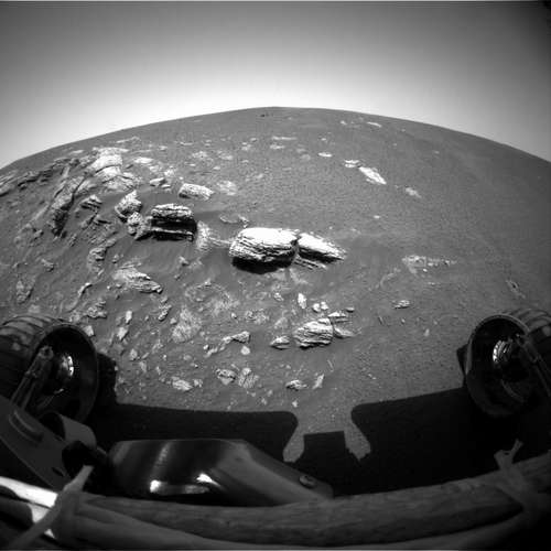
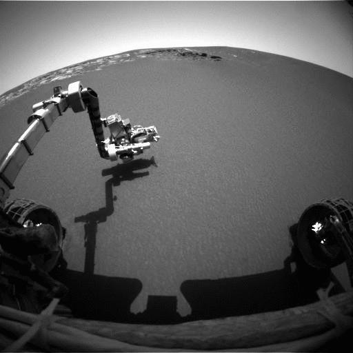
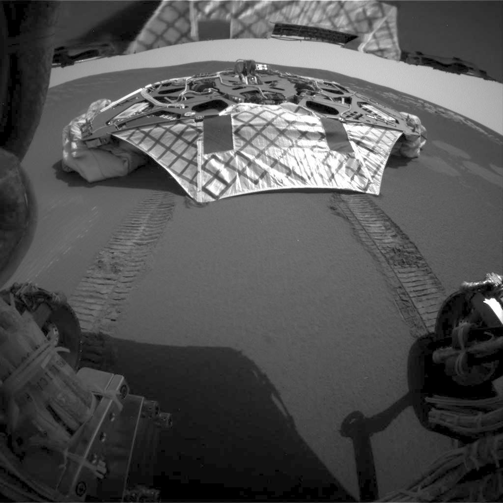
The Mars Exploration Rover Opportunity dragged one of its wheels back and forth across the sandy soil at
Meridiani Planum to create a hole (bottom left corner) approximately 50 centimeters (19.7 inches) long by
20 centimeters (7.9 inches) wide by 9 centimeters (3.5 inches) deep. The rover's instrument deployment
device, or arm, will begin studying the fresh soil at the bottom of this trench. Scientists chose this
particular site for digging because previous data taken by the rover's miniature thermal emission
spectrometer indicated that it contains crystalline hematite, a mineral that sometimes forms in the
presence of water. Opportunity's lander is in the center of the image, and to the left is the rock outcrop
lining the inner edge of the small crater that encircles the rover and lander. This mosaic image is made
up of data from the rover's navigation and hazard-avoidance cameras.
This color image taken by the Mars Exploration Rover Spirit's panoramic
camera on Sol 40 is centered on an unusually flaky rock called Mimi. Mimi
is only one of many features in the area known as "Stone Council," but
looks very different from any rock that scientists have seen at the Gusev
crater site so far. Mimi's flaky appearance leads scientists to a number
of hypotheses. Mimi could have been subjected to pressure either through
burial or impact, or may have once been a dune that was cemented into
flaky layers, a process that sometimes involves the action of water.
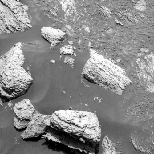


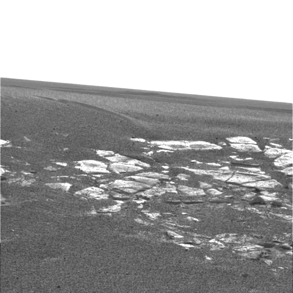
This high resolution image captured by the Mars Exploration Rover Opportunity's
panoramic camera highlights the puzzling rock outcropping that scientists eagerly
wait to investigate. These layered rocks measure only 10 centimeters (4 inches)
tall and are thought to be either volcanic ash deposits or sediments carried by
water or wind.
Full Resolution Version (4.1 Mb)

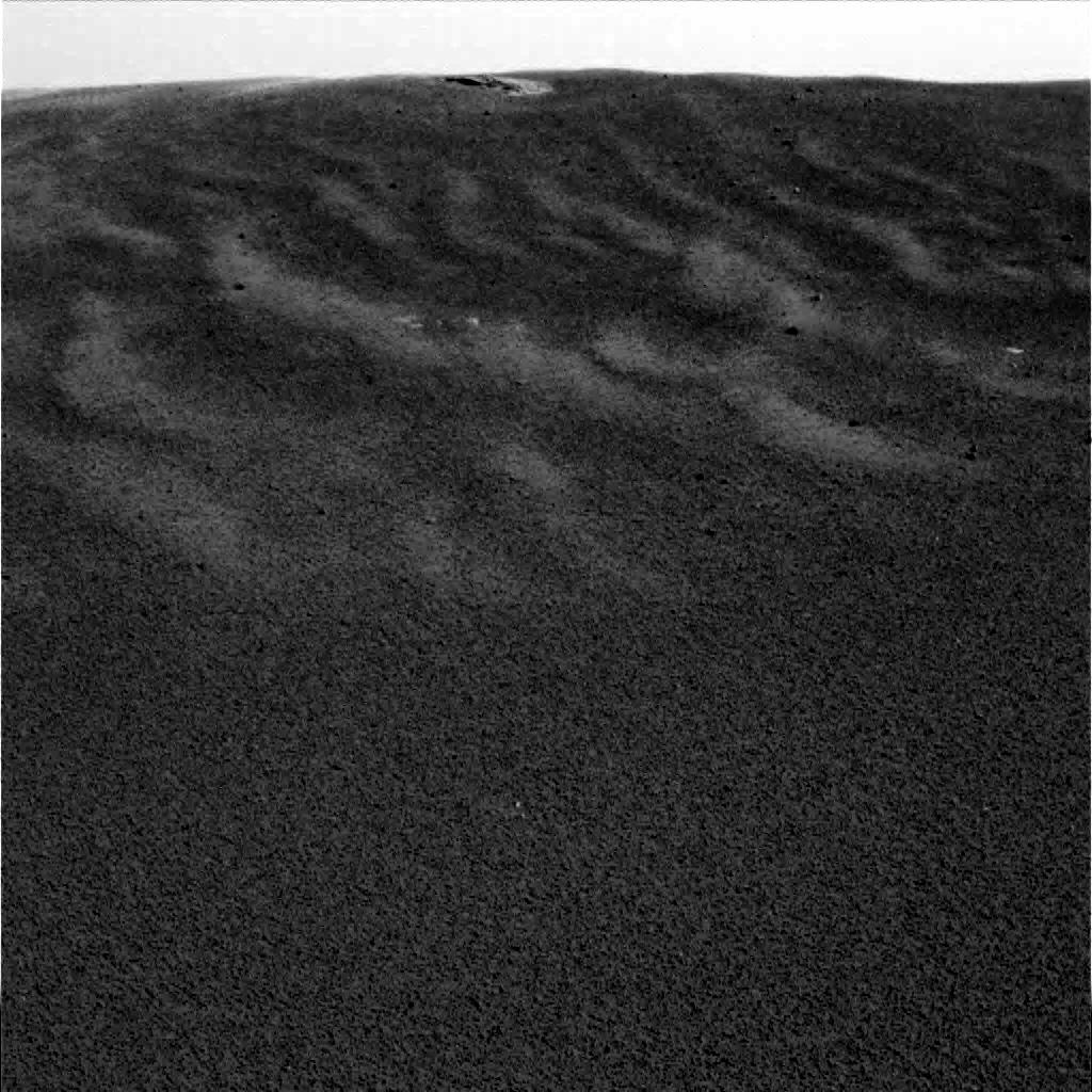
This image captured by the Mars Exploration Rover Opportunity's panoramic camera highlights the flat and dark terrain of its landing site at Meridiani Planum. The landscape is in contrast to that of past landing sites on Mars, which show variations in color and topography. For example, the Viking 1 and Viking 2 missions observed rocky, dust-covered surfaces much like those observed at Pathfinder's landing site. Gusev Crater, the landing site of the Mars Exploration Rover Spirit, is slightly darker in color but flat and speckled with a sparse array of rocks. Meridiani Planum has even fewer rocks than Gusev Crater and is darkest and cleanest of all the landing sites.

This high-resolution image captured by the Mars Exploration Rover Opportunity's
panoramic camera highlights a portion of the puzzling rock outcropping that scientists
eagerly wait to investigate. Presently, Opportunity is on its lander facing northeast;
the outcropping lies to the northwest. These layered rocks measure only 10 centimeters
(4 inches) tall and are thought to be either volcanic ash deposits or sediments
carried by water or wind. Data from the panoramic camera's near-infrared, blue and
green filters were combined to create this approximate true color image.
This high-resolution image captured by the Mars Exploration Rover Opportunity's panoramic camera
shows in superb detail a portion of the puzzling rock outcropping that scientists are eagerly
planning to investigate. Presently, Opportunity is on its lander facing northeast; the outcropping
lies to the northwest. These layered rocks measure only 10 centimeters (4 inches) tall and are
thought to be either volcanic ash deposits or sediments carried by water or wind. The small rock
in the center is about the size of a golf ball.

The interior of a crater surrounding the Mars Exploration Rover Opportunity at Meridiani Planum
on Mars can be seen in this color image from the rover's panoramic camera. This is the darkest
landing site ever visited by a spacecraft on Mars. The rim of the crater is approximately 10
meters (32 feet) from the rover. The crater is estimated to be 20 meters (65 feet) in diameter.
Scientists are intrigued by the abundance of rock outcrops dispersed throughout the crater, as
well as the crater's soil, which appears to be a mixture of coarse gray grains and fine reddish
grains. Data taken from the camera's near-infrared, green and blue filters were combined to
create this approximate true color picture, taken on the first day of Opportunity's journey.
The view is to the west-southwest of the rover.
Full Resolution Version (7.5 Mb)
This sweeping 3-D look at the unusual rock outcropping near the Mars Exploration
Rover Opportunity was captured by the rover's panoramic camera. Scientists believe
the layered rocks are either volcanic ash deposits, or sediments laid down by wind or water.
Panoramic view of the small crater in Meridiani Planum with Opportunity in the foreground.

Opportunity descent image showing large nearby crater and an improved image of the landing
site using the descent imager and Mars Global Surveyor images.
 Images from "Spirit" in Gusev Crater
Mars Rover "Opportunity" home page at NSSDC